The people living on top of ancient monuments and those who travelled from far away to engage in the excavation of those monuments collaborated to accomplish the goal of identifying the historic city of Ancient Corinth. Working hand in hand, these collaborators also created all that exists today from the archaeological landscape to the artefacts displayed and stored in the museum. The stories in the excavation notebooks and in the inventory cards of the finds are too numerous to pay individual tribute to all who have contributed to the collections archive during the last 129 years, particularly since this archive is constantly being augmented. As such, a few select vignettes will be presented here.
The Giambouranis well and the Bakoulis dump, as archaeologists have referred to them, are written in the memory of both the people who worked the areas and the generations of scholars coming afterwards. The newer generation tries to identify where precisely the well was located and what finds came from it, thus reconstructing the relationships between object and monument that initial research interfered with in the first place.
The American researchers collaborated with many local families in their attempt to uncover the ancient city. First and foremost, the land covering the monuments belonged to the people living on top of the monuments. These land plots had to be expropriated and donated to the Greek State before excavation would begin. Records exist both in terms of plans, photographs and excavation notebooks that record in detail the land, the owners and what antiquities were found in each place. Even today, people are constantly finding antiquities in their fields and they are the ones who know the landscape better than anyone and can teach the Americans about it.
In the following short stories, local Corinthian families will be featured so that people will know exactly what was found in each family’s plot of land after it was excavated and thus, how each of these families contributed to our collective knowledge about the past and the ancient people who lived where the modern families live hundreds of years later.
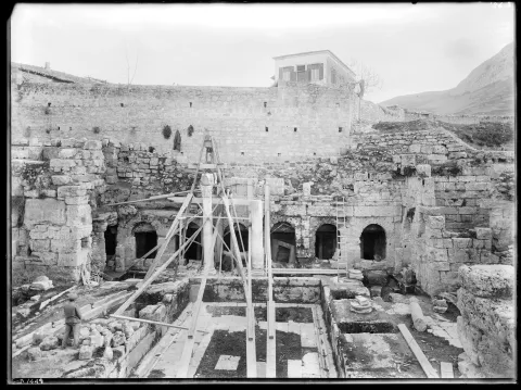
Gregorios Tselios' house on top of the fountain of Peirene, 1905
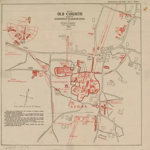
Map by Arthur S. Cooley with locations of monumnets and G. Tsellios House indicated
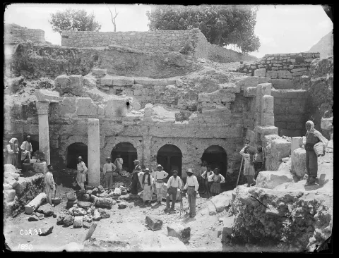
Peirene facade with a group of workmen, 1898
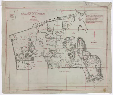
Map by Arthur S. Cooley with monuments as exposed by 1898. Property of G. Tsellios, field of Papapsomas and Bakoulis threshing floor indicated
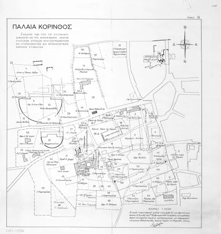
Map by Ioannis N. Travlos with names of owners of properties superimposed on monuments of archaeological site, 1965
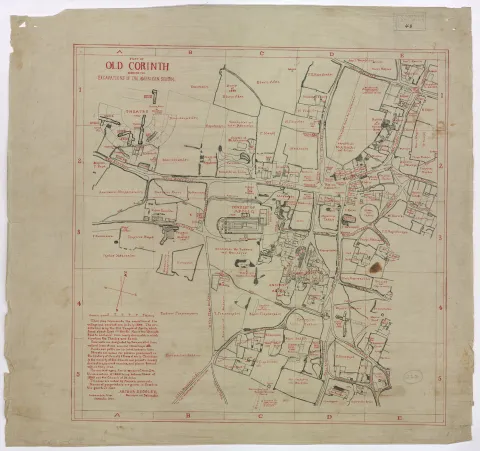
Map by Arthur S. Cooley with monuments as exposed by 1900. Properties indicated with Greek names of families
The Making of Ancient Corinth: Archaeological Landscape and Local Families in the Digital Archive of ASCSA